TerrAvion Uses AWS to Help Farmers Improve Crop Yields Through High-Resolution Aerial Images
---nasdaq--amzn_14.jpg "Amazon Web Services Logo")
Customer Company Size
SME
Region
- America
Country
- United States
- Brazil
Product
- Amazon Elastic Compute Cloud (Amazon EC2)
- Amazon S3 Glacier
- Amazon Simple Storage Service (Amazon S3)
- AWS Lambda
Tech Stack
- Amazon Web Services (AWS)
- Cloud Storage
- Cloud Computing
Implementation Scale
- Enterprise-wide Deployment
Impact Metrics
- Cost Savings
- Productivity Improvements
Technology Category
- Infrastructure as a Service (IaaS) - Cloud Computing
- Infrastructure as a Service (IaaS) - Cloud Storage Services
Applicable Industries
- Agriculture
Applicable Functions
- Logistics & Transportation
Use Cases
- Remote Asset Management
- Predictive Maintenance
Services
- Cloud Planning, Design & Implementation Services
- Data Science Services
About The Customer
TerrAvion is a company that provides aerial images to farmers throughout the United States and Brazil. The company’s core service—OverView—delivers subscription imagery overnight at each key agronomic event in the growing season. These farmers use imagery to make decisions that lead to more sustainable and profitable agriculture. The company is one of the largest providers of high-resolution aerial images by volume for farmers across the US and Brazil. TerrAvion runs its aerial-image data-processing application on Amazon EC2 and uses Amazon S3 and Amazon S3 Glacier to store multiple terabytes of images every day.

The Challenge
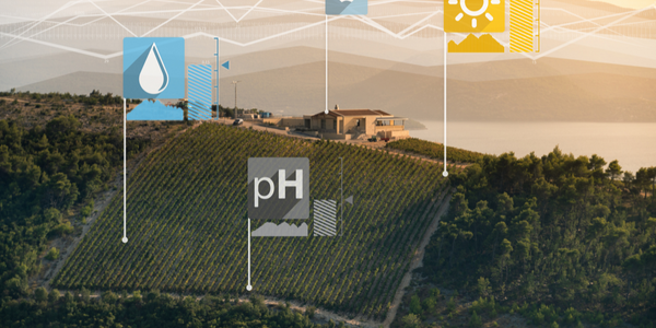
Commodity-crop farmers across the United States often depend on satellite images of their fields to get an updated view of the health of their crops. However, the resolution of these images is not high enough for farmers to get the most accurate picture of their fields. In fact, for many specialty-crop growers, satellite images are somewhere between useless and misleading. TerrAvion is changing that. The company uses airplanes and drones to obtain full-frame and thermal images from high-resolution cameras. TerrAvion gives farmers, retailers, agronomists, and ag distributors the best possible pictures through OverView, the company’s core subscription service. “Our pictures offer resolutions of 9 or 18 centimeters per pixel, which satellite can’t do,” says Stephen Smith, CTO of TerrAvion. Using such high-resolution images, farmers can more accurately view the health of a plant.
The Solution
TerrAvion started from day one as a cloud-native Amazon Web Services (AWS) customer. “We knew we were going to collect multiple terabytes per day, per aircraft, and needed to deliver fully processed images to our customers the day after the photos were taken,” Smith says. “Without the speed and economy of the public cloud, TerrAvion could not exist— everyone thinks drones are the big disruption in agriculture, but, in fact, it is 4G wireless and the public cloud.” TerrAvion was already using Amazon Elastic Compute Cloud (Amazon EC2) instances, powered by Intel® Xeon® processors, to support its online image-processing application. To accommodate its increasing image-storage needs, the company began using Amazon Simple Storage Service (Amazon S3) to ingest the aerial images each day. “Amazon S3 is highly scalable and reliable, which makes it the best solution for us. We use it to store aerial images as raw data,” says Smith. TerrAvion also uses Amazon S3 Glacier for long-term image-data storage and AWS Lambda to automatically identify when image data has been uploaded to the processing application. The company partners with several analytics technology companies to integrate image analysis and machine learning for farmers, who can turn that analysis into business insights about crop yields. “Being on AWS is important to us, because almost all of our partners are on AWS, which allows us to serve them terabytes of data from our Amazon S3 buckets as though our infrastructure was theirs, for free,” Smith says.
Operational Impact
Quantitative Benefit

Case Study missing?
Start adding your own!
Register with your work email and create a new case study profile for your business.
Related Case Studies.
Case Study
Intelligent Farming with ThingWorx Analytics
Z Farms was facing three challenges: costly irrigation systems with water as a limited resource, narrow optimal ranges of soil moisture for growth with difficult maintenance and farm operators could not simply turn on irrigation systems like a faucet.

Case Study
Greenhouse Intelligent Monitoring and Control Solution
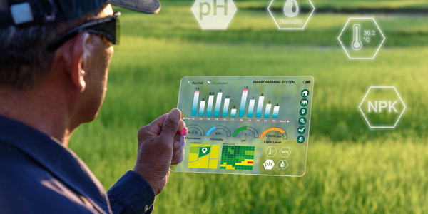
Farming Orchids is the most successful form of precision farming in Taiwan, and also the most exported flower. Orchids need a specific temperature and humidity conditions to grow and bloom, and its flowering time may not be in line with market demands, so the price collapses when there is overproduction. Therefore, some farmers began to import automated greenhouse control systems for breeding and forcing, which not only improves quality, but also effectively controls the production period and yield to ensure revenue. In 2012, an orchid farmer built a Forcing Greenhouse of about 200 pings (approximately 661 Square Meters) in Tainan, Taiwan. The system integrator adopted Advantech’s APAX-5000 series programmable automation controllers to build the control platform, coupled with Advantech WebAccess HMI/SCADA software, to achieve cloud monitoring. The staff of the orchid field can monitor important data anytime via smart phone, iPad, and other handheld devices, and control the growth and flowering conditions. System requirements: In the past, most environmental control systems of orchid greenhouses in Taiwan used PLCs (Programmable Logic Controller) with poorscalability and control, and could not be connected to the Internet formonitoring from the cloud. For advanced database analysis and networking capability, the PC platform must be adopted. Therefore, PAC Systems (Programmable Automation Controller) with both PLC programming capabilities andPC functions is a better choice.The environmental control of the Orchid greenhouse switches on and off devices like fan, shade net, cooling/heat pump, liquid flow control, water-cooling wall etc. It is controlled by a control panel of electric controllers, and is driven by a motor, to adjust the greenhouse temperature, humidity, and other environmental conditions to the set parameters.
Case Study
Enabling Internet of Things Innovation in Agriculture
DigiBale, wanted to apply technology know-how and IP from implementations successfully to more agriculture sectors including cotton, forestry, sugarcane and cattle. However, farmers and growers still have worries about the connected technology.
Case Study
Precision beekeeping with wireless temperature monitoring
Honeybees are insects of large economic value and provide a vital service to agriculture by pollinating a variety of crops. In addition, bees provide us with valuable products such as honey, beeswax, propolis, bee venom, etc. Monitoring of honeybee colony health, population, productivity, and environmental conditions affecting the colony health have always been exceedingly difficult tasks in apiculture. Research has shown that even small deviations (by more than 2°C) from the optimal temperatures have a significant influence on the development of the brood and the health of adult bees.
