Skyhook Wireless's Global Location Intelligence with CARTO

Technology Category
- Networks & Connectivity - WiFi
- Sensors - GPS
Applicable Industries
- Cement
- Cities & Municipalities
About The Customer
Skyhook Wireless is a company that provides location services on mobile devices. They build location-based services using wifi, which allows them to put a blue dot on the map to represent a device's location. The data generated from these services is used for various purposes, including analysis by businesses. As the company expanded its services globally, the amount of data they generated grew exponentially. This data, combined with the growing expectations of businesses for detailed data analysis, presented a significant challenge for the company.

The Challenge
Skyhook Wireless, originally a provider of location on mobile devices, was facing the challenge of managing and utilizing the enormous amount of data generated from their location services. The data, which was being used to provide location-based services like pinpointing a device's location on a map, was growing exponentially as the company expanded its services globally. The challenge was not just managing this data, but also compartmentalizing it into usable pieces for analysis. The expectation of high spatial-temporal accuracy, which was once a stretch for a county or a city, was now expected on a global scale. Furthermore, the company was also facing the challenge of meeting the growing expectations of businesses that required detailed data analysis, such as the number of burgers sold in one McDonald's location versus another.
The Solution
Skyhook Wireless turned to CARTO's Location Intelligence Platform to manage and analyze their spatial data. The platform allowed them to handle the vast amount of data generated from their location services and break it down into usable pieces for analysis. With CARTO's platform, Skyhook was able to provide high spatial-temporal accuracy on a global scale, meeting the growing expectations of their clients. The platform also enabled them to keep up with the increasing demand for detailed data analysis from businesses. By leveraging the geospatial science laid down 30 or 40 years ago and layering it with modern technology, Skyhook was able to transform their data into a necessary component of any analytical fact.
Operational Impact

Case Study missing?
Start adding your own!
Register with your work email and create a new case study profile for your business.
Related Case Studies.

Case Study
Turning A Stadium Into A Smart Building
Honeywell created what it called the “intelligent system” for the National Stadium in Beijing, China, turning the venue for the opening and closing events at the 2008 Summer Olympics into a “smart building.” Designed by highly controversial artist Ai Weiwei, the “Bird’s Nest” remains one of the most impressive feats of stadium architecture in the world. The 250,000 square meter structure housed more than 100,000 athletes and spectators at a time. To accommodate such capacity, China turned to Honeywell’s EBI Integrated Building Management System to create an integrated “intelligent system” for improved building security, safety and energy efficiency.

Case Study
System 800xA at Indian Cement Plants
Chettinad Cement recognized that further efficiencies could be achieved in its cement manufacturing process. It looked to investing in comprehensive operational and control technologies to manage and derive productivity and energy efficiency gains from the assets on Line 2, their second plant in India.
.png)
Case Study
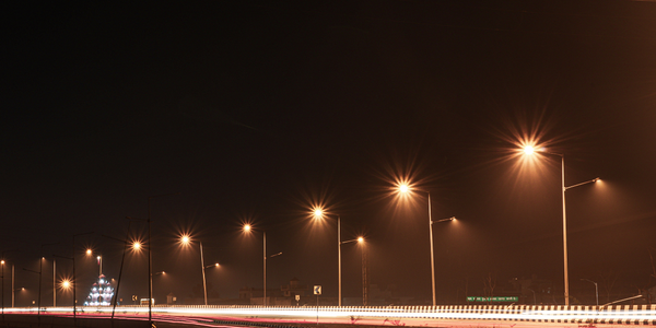
Smart Street Light Network (Copenhagen)
Key stakeholders are taking a comprehensive approach to rethinking smart city innovation. City leaders have collaborated through partnerships involving government, research institutions and solution providers. The Copenhagen Solutions Lab is one of the leading organizations at the forefront of this movement. By bringing together manufacturers with municipal buyers, the Copenhagen Solutions Lab has catalyzed the development and deployment of next-generation smart city innovations. Copenhagen is leveraging this unique approach to accelerate the implementation of smart city solutions. One of the primary focus areas is LED street lighting.
Case Study
Buoy Status Monitoring with LoRa
The Netherlands are well-known for their inland waterways, canals, sluices and of course port activities. The Dutch Ministry of Infrastructure indicates that there are thousands of buoys and fixed items in and near water environments that would profit from IoT monitoring. One of the problems with buoys for example, is that they get hit by ships and the anchor cable breaks. Without connectivity, it takes quite some time to find out that something has happened with that buoy. Not to mention the costs of renting a boat to go to the buoy to fix it. Another important issue, is that there is no real-time monitoring of the buoys at this moment. Only by physically visiting the object on the water, one gains insight in its status.

Case Study
China Mobile Smart Parking
Smart Parking, powered by NB-IoT technology, is making it easier for drivers to find free parking spots. Cities can better manage their parking assets and maximize the revenue available to them as a result. Drivers searching for parking create congestion and pollution by circling and hunting for available parking. Smart Parking services are able to significantly ease these problems by guiding a driver directly to a parking space.
